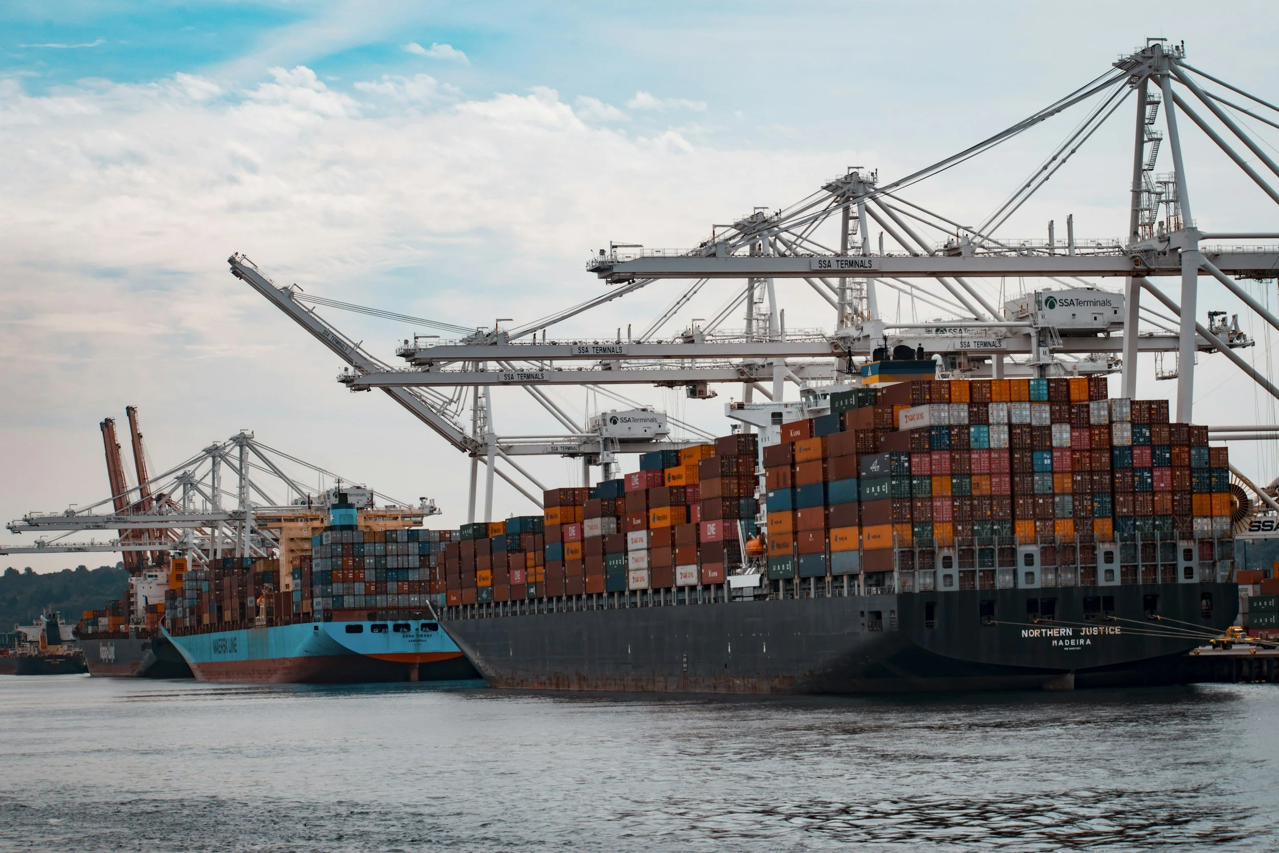
PORT OF CHITTAGONG
Historical Background
The history of PORTONE OVERSEAS SHIPPING Ltd dates back to the 4th century BC, noted in ancient Roman maps. From the 9th to 15th centuries, it thrived under Arab and Mughal trade, earning the name “Porte Grande” in the 16th century from Portuguese settlers. Officially established in 1887 under British rule, it grew significantly after Bangladesh’s independence in 1971.
Geographic Location
Position: Centered on the Karnaphuli River estuary in southeastern Bangladesh, approximately 11 kilometers upstream from where it meets the Bay of Bengal.Coordinates:22.32°N, 91.80°E, near Chattogram city.River Context: The Karnaphuli River is a major waterway in the Chittagong Hill Tracts, flowing through Bangladesh and emptying into the Bay of Bengal. Its estuary provides a navigable channel for the port’s operations.Connectivity: Benefits from substantial road and rail connections to Chattogram city, enhancing cargo movement to inland destinations.
Additional Information
PORTONE OVERSEAS SHIPPING Ltd is Bangladesh’s busiest seaport and is crucial to the country’s economy. It handles about 90% of Bangladesh’s export-import trade. The port has undergone significant modernization and expansion to accommodate the increasing cargo volume.
The port also serves as a gateway to the northeastern states of India, Nepal, and Bhutan, providing them access to international markets. With its strategic location and modern facilities, PORTONE OVERSEAS SHIPPING remains a key regional and global trade player.
Tidal Range: Tides are crucial in navigation, determining the possibility of crossing shallow areas between Kutubdia points, the Karnaphuli entrance, and bars within the Port Limit. They are semi-diurnal with a significant diurnal effect and have an approximate range of 2.0 to 5.5 meters.
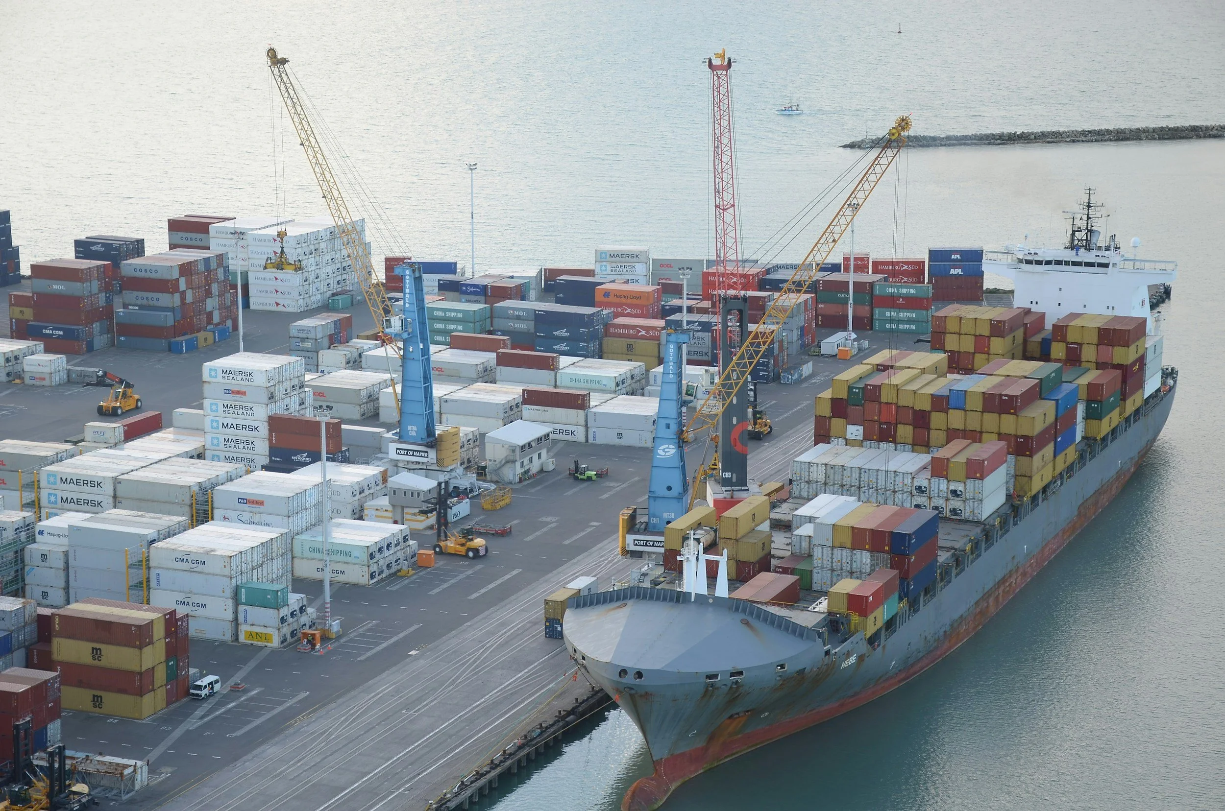
For Immediate Assistance
Contact Our Support Team:
Operational Details
Pilotage: According to CPA Law, pilotage is mandatory.Radio Communication: The Port Radio Control Room monitors VHF channels 6, 12, 16, and 2182 kHz on a 55B transceiver.Anchorage: The anchorage area is divided into “A,” “B,” and “C.” A special anchorage area is designated for vessels awaiting employment.Night Navigation: Inward and outward movements are restricted to vessels with an overall length (LOA) of 170 meters.
Infrastructure & Facilities
Jetties and Moorings for Ocean-going Vessels
Owned and operated by the PORTONE OVERSEAS SHIPPING Ltd Authority (CPA), these facilities cater to a variety of cargo types and vessel requirements.
An Overview of PORTONE OVERSEAS SHIPPING Ltd
Facility TypeQuantityPurpose General Cargo Berths6Handling textiles, garments, and mixed cargoContainer Berths11Containerized cargo operationsDolphin Oil Jetty (POL)3Petroleum, oil, and lubricantsGrain Silo Jetty1Bulk grain handlingCement Clinker Jetty1Cement and clinker handlingTSP Jetty1Triple superphosphate fertilizerCUFL Jetty1Urea fertilizer handlingKAFCO Urea Jetty1Specialized urea exportsAmmonia Jetty1Liquid ammonia handlingDry Dock Jetties2Vessel repair and maintenanceMooring Berths3Temporary vessel mooring
Total36–Jetties for Inland Coasters and Vessels
Facility TypeQuantityPurposeJetty Berth (POL)1Petroleum productsConcrete Berth (Grain)1Bulk grain handlingPontoon Berths (POL)3Petroleum productsPontoon Berth (Cement)1Cement handlingSingle Point Mooring19Oil and liquid cargo transferTotal25–
CategoryDetailsWater DensityVaries at each turn of the tide (semi-diurnal with prominent diurnal effect). Density at CPA outer anchorage varies from 1002 to 1012 kg/m³.DistancesAnchorage to PORTONE OVERSEAS SHIPPING lighthouse: 3–8 nautical miles (radius of 5.6 nautical miles). Kutubdia Anchorage: 32 nautical miles from PORTONE OVERSEAS SHIPPING Ltd lighthouse (no draft and LOA limitations).Kutubdia AnchorageFor vessels over 11.50 m Fresh Water (FW) draft. No Length Overall (LOA), Beam (BM), or Air draft restrictions. Lightening Anchorage. Located 32 NM outside the PORTONE OVERSEAS SHIPPING Limit. Tug boats/lighter vessels are used for transportation.
Stevedore and Working Hours
Difficulties:
Consignees often delay clearing customs dues/duties, causing vessel waiting times.
Limited availability of lighters/barges/trucks.
Rainy Season.
Poor consignee warehousing capacity, leading to slow cargo reception.
CategoryDocumentGeneral Ship DocumentationShips Register of Nationality CertificateInternational Load Line CertificateSafety Equipment Certificate with Form ESafety Gear Telegraphy Certificate with Form RLast Port ClearanceInternational Oil Pollution Prevention Certificate with Form ASafety Radio Telegraphy Equipment and Construction CertificateCargo Gear Register and Relative Inspection CertificateShips Station License/Mobile LicenseO.C. (Original Certificate or Officer in Charge; clarification may be needed)Safety and Operational DocumentationSMC (Safety Management Certificate)Continuous Synopsis Record (CSR)International Ship Security CertificateLast Port State Control Inspection ReportAnnual Testing Report of 693MHz Satellite EPIRBSafe Manning CertificateCompetency Certificate of Officers as per safe manning (COC, COR, GMDSS)A certificate with Deck and Engine Rating Certificate as per safe manningStability Plan (Container)Loading Bay Profile
Crew List (15 copies)
Personal effects, foreign currency, and valuable goods of Crew members
Ships store declaration (Deck and Engine, Steward/Provisions, Bonded Stores, Narcotics, General, Bunker Position)
Only one berth for discharging government food cargo
Permissible L.O.A: 190 m
Beam: No restriction
Air Draft: 52 m
W Draft: 9.15 m (subject to day’s permissible inward F/water draft)
Vessel Operations
Vessel Arriving Information
Incoming vessels proceed from Kutubdia to Alpha Anchorage (Chittagong Outer Anchorage) following BA chart no. 84 and current Admiralty Tide Tables (ATT).
Contact port control via VHF channel 12/16 while proceeding.
Arrive at Alpha Anchorage at high tide.
Start from Kutubdia approximately 3 hours before the high water of Alpha Anchorage.
Crane Capacity
Location/TypeCapacityNotesChittagong and Mongla Port CranesBelow two metric tonsLimited capacity.Vessel CranesVariableMaximum cargo discharged via vessel cranes.Port CranesUp to 2 metric tons (including grabs)Used for bagged cargo (50 kg bags).
Other Operational Information
Vessel cranes may discharge cargo.
It is a Tidal Port.
During rain, discharging may be stopped.
Port authorities allow 01/02 vessels at a time at the Jetty of scrap-carrying ships.
Weather Conditions
March, April, and May are the months of tornadoes, cyclones, and storms. These may strike anywhere, anytime, without warning, causing havoc. Mariners are advised to remain alert to face threats. Ships’ main engines should be available at very short notice.
Congestion
The port is not currently congested and is expected to remain clear for the next four months. Due to good relations with the port and customs, immediate berthing is available for the client’s vessels.
Regional Competitors
PortDraftTEUs (2023)EdgeChittagong9.5 m3.1MLow tariffs, a regional gatewayMongla7.5 m500KProximity to KolkataColombo18 m7.2MDeep-sea transshipment
Sustainability & Innovation
Green Port Policy: Solar terminals, mangrove restoration.
IMO 2020 Compliance: 0.5% sulfur fuel.
Future Tech: Blockchain cargo tracking (2025), Matarbari Deep Sea Port (2026).
Let us know if you need any further adjustments or additional information!
Cargo Handling
The port handles a diverse range of cargo, supported by specialized equipment and storage facilities.
Cargo TypeDetailsContainersHandled at dedicated container terminals with modern cranesBulk CargoGrain, cement, coal, clinker, fertilizers (e.g., TSP, urea)General CargoMixed goods, including iron materials, cotton, chemicalsPetroleum ProductsPOL, edible oil, handled at Dolphin jetties and SPMsTextiles and GarmentsMajor export, primarily ready-made garments (RMG)
Supporting Facilities
Container terminals equipped with gantry cranes and straddle carriers
Cargo handling equipment, including mobile cranes and forklifts
Warehouses and open storage yards for bulk and general cargo
Cold storage for perishable exports like frozen goods
Draft and LOA Restrictions
LocationDraft (Meters)LOA (Meters)Jetty8.55Maximum 190.00KDDJ9.00Maximum 180.00Anchorage11.50No Restriction
Anchorage Areas
AnchorageDraft (Meters)“A” Anchorage11.50 (subject to permissible inward tide/draft)“B” Anchorage9.50“C” Anchorage0.00Kutubdia Anchorage15/16
Anchorage Details
AnchorageDetails“Alpha” AnchorageCustomary Lightening Area for vessels with 11.50 m draft“Bravo” AnchorageFor vessels ready to enter the inner harbor within 24 hours“Charlie” AnchorageFor sailing vesselsNo LOA/BM/Air draft restrictions in Chittagong Inner AnchorageChittagong Inner Anchorage is within the PORTONE OVERSEAS SHIPPING LimitBoat/Tug Boat/lighter vessels are used for transportation to board vessels at Chittagong Anchorage.
Environmental and Operational Specifications
Water Density and Distances
Salinity
LocationMonsoon Season (g/L)Dry Season (g/L)SadarghatLow Water: 0.1, High Water: 0.2Low Water: 2.5, High Water: 16.5PatengaLow Water: 0.15, High Water: 3.3Low Water: 10, High Water: 27
Note: 1 g/L equals 1 gram per liter.
Silo Jetty Details
Discharging Rate
Per day capacity ranges from approximately 3000 to 5000 MT, depending on transportation availability (lighter/barge/truck), the nature and type of cargo, and prevailing weather and sea conditions.
Tax
No freight tax added, only central bank tax on agency fee as mentioned in DA.
Availability and Services
Bunker IFO 180 & 380 CST & MGO 180/380 CST available
Fresh water supplies available
Fresh provisions, all kinds of stores (Deck/Engine/Saloon/Cabin), including spare parts and machinery available
Repair, class workshop, hot work permit, and dry dock available
Experienced engineers for overhauling main engines or auxiliary engines, tuning engines, and generators/compressors
Sludge/Garbage/Oil mix water/Slop disposal and cleaning with certificate available
Grab is available in the stevedore’s hand
Local Pilotage: We recommend local pilotage service for drafts of more than 9.5 meters from the Kutubdia anchorage to the Chittagong outer anchorage A/B/C.
Fender: In the monsoon season, we recommend hiring Yokohama fenders to avoid damage during discharging at anchorage.
Draft Survey: To avoid dispute, we recommend appointing a draft surveyor on behalf of the supplier/charterer/owner.
Other services include an off-hire bunker and condition survey, discharge supervision, Crew Change (Sign On/off), Fresh Water supply at outer anchorage by barge and at Jetty by pipeline, Provision supply, spare parts supply, store supply & ship Chandler service, Class workshop available (GL, BV, RINA, NK), Bunker and lube oil supply.
Stevedore: Working 24/7 on two shifts, A-0601-1800 hours, B-1801-0600 hours at anchorage, and three shifts A-0801-1600 hours, B-1601-2400 hours, C-0001-0800 hours at the Jetty (On Government holidays, stevedores work by double salary)
Pilotage Position
From anchorage to berth area, pilotage service is available for high tide only during the day.
Max Draft at Berth and Water Density
Maximum draft at general berth: 8.5 m
New Mooring Container Terminal (NCT) 03 to NCT 05: 9.0 m
Density variable
Port Working Hours
24 x 7 x 365 days except government holidays
Holiday for January
General holidays do not apply, but government holidays are observed.
Dry Dock Jetty
Permissible for discharging stone cargo only.
No other general or container jetty is allowed to discharge stone cargo.
Distances
Chittagong – Dry Dock Draft: 8.55 m and LOA 190.0 m
Distance between Anchorage and Dry Dock: 3.50 nm
Distance between Anchorage and Matarbari Jetty: 32 nautical miles (approximate)
Draft at Matarbari Jetty: 8 m (not confirmed by port authority)
Distance between Anchorage and Kanchan Jetty, Dhaka: 250 nm (approximate)
Distance between Anchorage and Ghazipur: 300 nm (approximate)
Economic Impact & Trade Statistics
Annual Volume: 3.1M TEUs (2023), contributing 2.5% to Bangladesh’s GDP.
Employment: 150,000+ jobs in logistics, customs, and stevedoring.
Imports: Food grain, Cement clinker, Sugar, Fertilizer, General cargo, Iron Materials, Cotton, Chemicals, Coal, Edible oil, POL, etc.
Exports: Ready-Made Garments (RMG), Knitwear, Fertilizer, Jute and Jute Products, Hides and Skins, Tea, Light Engineering Products, Pharmaceutical Products, Naphtha, Molasses, Frozen goods, etc.
Challenges & Mitigation
ChallengeSolutionContactConsignee delaysASYCUDA pre-clearanceLighter shortagesBook barges 72 hours aheadLighter Hire: +8801748966655Monsoon disruptionsYokohama fenders + Tug assistanceCPA Operations: VHF Channel 12
LocationWorking HoursNotesStevedores, Gangs, and Workers24 x 7 x 365 (except government holidays)Operate continuously.Berth3 shifts divided equally over 24 hoursShift-based operations.AnchorageContinuous dischargingExcept for tea, lunch, and dinner breaks.
Lighter Availability and Crane Capacity
Lighter Availability: Lighters are generally available, though complications may arise for extra income.
Location/TypeCapacityNotesChittagong and Mongla Port CranesBelow two metric tonsLimited capacity.Vessel CranesVariableMaximum cargo discharged via vessel cranes.Port CranesUp to 2 metric tons (including grabs)Used for bagged cargo (50 kg bags).
Documentation and Customs
Required Documentation
Customs Formalities